|
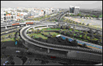
Roads Alignment, Ramps, Bridges and Tunnel Survey.
|


|
|
|
SNon-Pavement Elements Survey.
|
|
|
Road Distresses (Rutting, Cracking, Roughness, Raveling …) Survey.
|
|
|
Surveyed Data Analysis and Classification, and Developing & Integrating Surveyed GIS Database.
|
|
|
Digital Maps, Reports and Charts Generation for various types of data.
|
|
|
Mathematical and Statistical Data Modeling, and represents the output on GIS Maps.
|
|
|
Extract Maintenance Decision Priorities.
|
|
|
Traffic Studies: Accidents, Traffic Volume, Speed, & Information Signs, ....
|
|
|
Analysis of Feasible areas for Highway based on Land use / Land cover, Geo-technical and Soil mapping.
|
|
|
Road Design Studies, and Planning for Optimum Route, Irrigation, Planting, and Lightening.
|
>>
Back |
|